Photos of Maun and the Okavango, Botswana


Maun and the Okavango
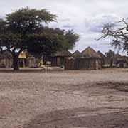
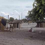
Maun was founded in 1915 as the tribal capital of the Batawana people; its name was derived from the San word “maung”, which translates as “the place of short reeds”. It is now the fifth largest town in Botswana, with a population of over 55,000. It is the administrative centre of the Ngamiland District in the northwest of the country. Maun has become the “tourism capital” of Botswana, the gateway to the Okavango Delta, safaris into the Moremi Game Reserve and, further north, Chobe National Park, known for its large herds of elephants and Cape buffalo. There is now a highway linking it with Francistown, about 490 kilometres away. Since these photos were taken, there have been a lot of changes.
you may then send it as a postcard if you wish.
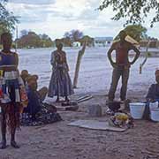
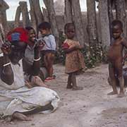
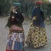
Apart from Tswana-speaking people, in Maung also live a group of Herero, a traditional pastoralist people. Most Hereros live in Namibia, with some also in Angola. When Namibia was German South West Africa in the late 19th and early 20th century, they were ruthlessly prosecuted, thousands killed and driven into the desert; the Herero in Maun may be descended from survivors of the German campaigns of those days who made it to the Okavango Delta. German missionaries had converted the Herero, who then abandoned their leather garments with the women adopting the fashions of the German missionary women, the clothing they wear until this day.
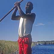
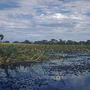
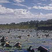
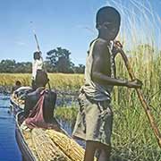
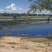
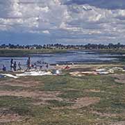
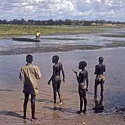
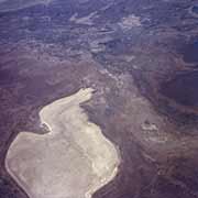
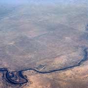
The Okavango Delta is a vast, swampy, inland river delta of between 6,000-15,000 km², depending on the amount of water. The Okavango River flows onto a plain where it ultimately evaporates; some floodwaters also flow into Lake Ngami, south of the delta. The Okavango River drains summer rainfall on the highlands in Angola over around 1,200 kilometres in approximately one month. The waters then spread out in the delta over the next four months, from March to June. The area is a permanent and seasonal home to various wildlife and, therefore, is now a popular tourist attraction. The locals used dugout canoes; there are five Okavango Delta ethnic groups, each with its own ethnic identity and language, including Bushmen groups, but since the late 18th century, it has been under the political control of the Batawana, a Tswana speaking group.
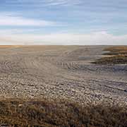
Between Maun and the village of Nata, 300 kilometres to the east, is the Makgadikgadi Pan, a salt pan situated in the middle of the dry savanna of north-eastern Botswana and one of the most extensive salt flats in the world. Lying southeast of the Okavango Delta and surrounded by the Kalahari Desert, Makgadikgadi is technically not a single pan but many pans with sandy desert in between, the largest being the Sua (Sowa), Nwetwe and Nxai Pans. These are seasonally covered with water and grass and are a refuge for birds and animals in this very arid part of the world. The primary water source is the Nata River, flowing in from Zimbabwe.