Photos of Sagaing and Mingun, on the Ayeryawady, Myanmar

Sagaing and Mingun, on the Ayeryawady
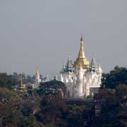
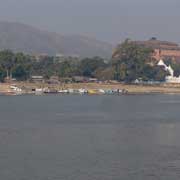
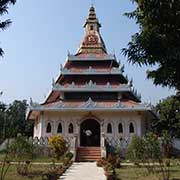
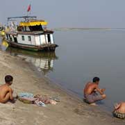
The Sagaing Region, formerly Sagaing Division, stretches from just west of Mandalay all the way up to the north west, bordering India's states of Nagaland and Manipur. The region has an area of 93,500 km² and a population of over 6.5 million. It is named after its capital, a lovely place of monasteries, around 6,000 monks and 500 stupas, in the south eastern corner of the region, on the west bank of the Ayeyarwady (Irrawaddy) river.
you may then send it as a postcard if you wish.
The Pyu people had populated this area by the 1st century CE; the Bamar (Burmans) came around the 9th century and had founded the Pagan Empire 200 years later. After Pagan had fallen, this region became the Sagaing Kingdom in 1315, ruled by Shan kings, who had adopted Burman civilisation. This kingdom collapsed in 1364 when the city of Sagaing was sacked by Shan raiders from Mogaung, then a princely state, now a town in Kachin State way to the north east. It then came under the rule of the kings of Inwa (Ava); in 1752 Ava was sacked by the Mon and Sagaing was again a royal capital until 1765 when Hsinbyushin, who had ascended to the throne in 1763, had Ava rebuilt and officially moved the kingdom's capital back from Sagaing. it was conquered by Britain and after independence in 1948 became the Sagaing Division.
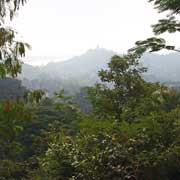
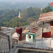
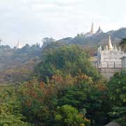
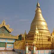
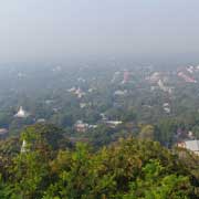
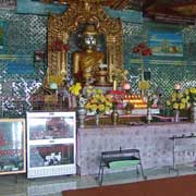
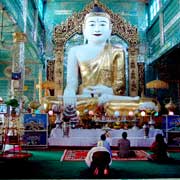
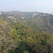
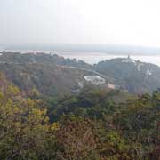
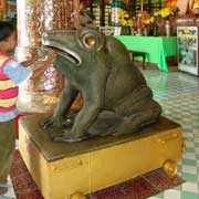
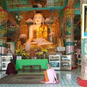
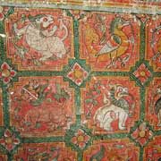
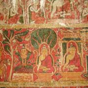
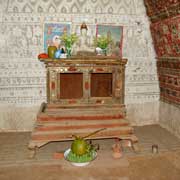
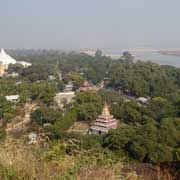
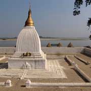
Sagaing Hill has stone steps leading past stupas, monasteries and nunneries. There is a cave temple, Tilawkuru, with colourful murals, the Soon U Ponya Shin Paya from 1312 with impressive Buddha statues and collection boxes in the shape of huge frogs and glorious views of the many temples, stupas and the Ayeryawady River below.
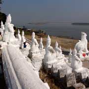
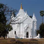
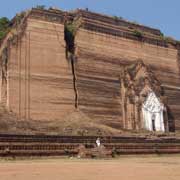
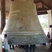
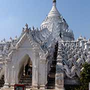
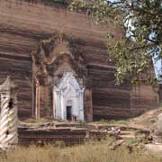
Just a few kilometres upstream is Mingun with looming Mingun Pahtodawgyi, actually just the brick base of a pagoda that was to have been 150 metres high. Building was started in 1790 with slave labour, on the orders of King Bodawpaya, but it was never finished: an astrologer had claimed that the king would die upon completion of the temple. It would have been the largest stupa in the world. Work was stopped in 1819 when the king died and the earthquake of 23 March 1839 caused huge cracks in the base. An enormous bell for the stupa had been cast on the orders of King Bodawpaya; it is now hung in a shrine building, weighs 90 tons and is the second largest ringing bell in the world: 4 metres high and 5 metres across the lip. A bell in Moscow is still larger, but cannot ring as it is cracked. Another great sight is Hsinbyume Paya or Myatheindan, built in 1816 by King Bagyidaw in memory of his first consort Princess Hsinbyume (Lady of the White Elephant), Bodawpaya's granddaughter, who had died while giving birth. It is meant to represent Sulamani Paya atop Mount Meru; the whitewashed terraces around the stupa represent the seven mountain ranges around Mount Meru, the centre of the universe.