Övörkhangai Province

Mongol Empire Map

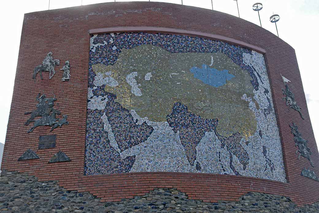
A map showing the extend of the Mongol Empire (13th century), one of the maps at the Great Imperial Map Monument, on a hill overlooking the town of Kharkhorin and the Orkhon river valley; it was built in 2004 .

Photo by Ludo Kuipers, Sat Aug 13, 2011
Back
To send this Photo as a Postcard:
Click or tap here:
Postcard
Postcard
 
To send this photo as a Postcard, fill in the boxes:
Mongol Empire Map Your name:
Your e-mail address:
Who to send it to?
Their e-mail address:
Type a Heading;
their name appears here:

(you may type over this)
Type your Message here:
Sign your card;
your name appears here:

(you may type over this)
Preview your Postcard, Start again or Cancel:
CANCEL

To send this photo as a Postcard, fill in the boxes below:

Mongol Empire Map What is your name?
What is your e-mail address?
Who you want to send it to?
What is their e-mail address?
Type a Heading (Their name automatically appears here):
(you may type over this)
Type your Message here:
Sign your Postcard: (Your name automatically appears here)
(you may type over this)
Preview your Postcard, Start again or Cancel:
CANCEL