Photos of Azad Kashmir and Gilgit-Baltistan, Pakistan

Azad Kashmir and Gilgit-Baltistan
The Princely State of Kashmir and Jammu was formed after the First Anglo-Sikh War of 1845-46, between the Sikh Empire, which asserted sovereignty over Kashmir, and the East India Company. The first Maharaja, Gulab Singh, founded a dynasty. The state included Jammu, Kashmir and Ladakh (all now in India), the Northern Areas (now Pakistani Gilgit-Baltistan), Aksai Chin and the Trans-Karakoram Tract (both currently occupied by China).
you may then send it as a postcard if you wish.


When in 1947 British India was partitioned, Hari Singh, the Maharaja of the Princely State of Kashmir and Jammu, initially wanted his state to remain independent. However, following a Muslim rebellion in Poonch, the western districts around Muzaffarabad, Pashtun tribesmen invaded, to force it to join Pakistan. Hari Singh’s forces were defeated, and he then appealed to India for help. Lord Mountbatten, the last Governer-General of India, advised him to accede to India before Indian troops could be sent. Maharaja Hari Singh then agreed that all of Jammu and Kashmir would join India. This decision triggered the Indo-Pakistani War of 1947–1948. It ended in a ceasefire in which India gained control of about two-thirds of Kashmir: the Kashmir valley, Jammu, and Ladakh. The “Line of Control” has divided the former state ever since.
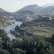
Pakistan now administers Azad Jammu and Kashmir, usually referred to as “Azad Kashmir” (Free Kashmir), a narrow stroke of land in the west of the Kashmir region, centred on its capital Muzaffarabad. The Line of Control is the de facto border with Indian Jammu and Kashmir. To the north of this line were the remote areas of the Gilgit Agency and Baltistan; these were initially governed by Azad Kashmir, although mainly neglected because of their remoteness. In 1963, Pakistan entered into a treaty with China to transfer part of the Gilgit Agency to China (the Trans-Karakoram or the Shaksgam Tract). The proviso was that the settlement would be subject to the final solution of the Kashmir dispute.
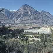
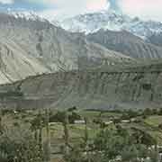
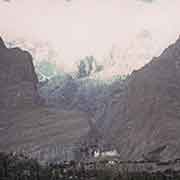
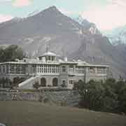
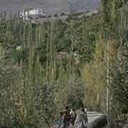
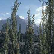
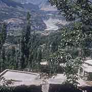
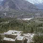
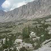
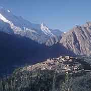
The Gilgit agency had within its boundaries in its far north the small princely state of Nagar (from 1868 a vassal of the Maharaja of Jammu and Kashmir) and its north the princely state of Hunza. Hunza (also known as Kanjut) had been an independent principality for centuries, governed by rulers, known as Mirs. Since 1761 they had acknowledged the Emperor of China as suzerain and even assisted China against Uyghur separatists. But in 1891, the British mounted the “Hunza-Nagar Campaign” and established control of Hunza and neighbouring Nagar. Although part of Jammu and Kashmir, Hunza was never ruled directly by that state and on 3 November 1947, Hunza’s Mir, Muhammad Jamal Khan, acceded his state to Pakistan. In the beautiful Hunza Valley, he remained in his palace in the capital Baltit (renamed Karimabad) at an altitude of 2,500 metres. On 24 September 1974, Pakistani President Zulfikar Ali Bhutto abolished the Mir’s government and annexed the region to Pakistan’s Northern Areas under the federal government. Hunza’s people speak a unique language, Burushaski, that has not been found to have a relationship with any other language.
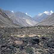
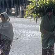
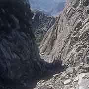
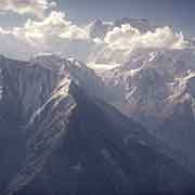
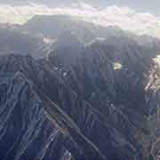
Baltistan, to the east of Gilgit, is near the Karakoram mountains, just south of K2, the world’s second-highest peak. To the east is the, now Chinese occupied, Trans-Karakoram Tract and Xinjiang, and to the south the Indian territory of Ladakh. It also used to be known as “Little Tibet”: its people, like in Ladakh, are of Tibetan descent and refer to the country, in Tibetan, as Baltiyul. The capital is Skardu. Because of Muslim missionary activity in the region since the 14th century, most inhabitants now are Muslim.
The Gilgit Agency, the small princely states, including Nagar and Hunza, and Baltistan, were separated from Azad Kashmir in 1970 and made into a separate administrative unit as the “Northern Areas”. Because of the ongoing dispute with India about the final status of Jammu and Kashmir, it was not made into a province, but granted limited autonomy in 2009 and renamed “Gilgit-Baltistan”. But it seems likely that in the near future it will attain provincial status.