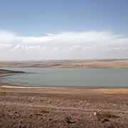
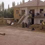
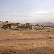
Photos of Central Anatolia: the historical region of Cappadocia, Turkey


Central Anatolia: the historical region of Cappadocia
The historical region of Cappadocia (Kapadokya in Turkish) in central Anatolia is first mentioned in the late 6th Century BCE. It was one of the countries of the Persian Empire and named “Katpatuka”, a name presumably of Hittite origin, meaning “place-below”. In the late Bronze Age, it was part of the Hittite empire, around 1600 BCE and became later became a satrap (province) of the Persian Empire. Around 320 BCE it became an Iranian kingdom, although its official language was Greek after the conquests of Alexander the Great. The Cappadocian kings Hellenised various aspects of the nation.
you may then send it as a postcard if you wish.
The Kingdom of Cappadocia allied itself with the Roman Empire in the 2nd Century BCE. It became a client kingdom in 95 BCE and was made a Roman province by Emperor Tiberius in the year 17 CE. In the year 371, the western part of Cappadocia was divided into two parts. Cappadocia Prima had its capital Ceasarea (now named Kayseri) and to its south was Cappadocia Secunda with its capital Tyana (now called Kemerhisar). The land east of Kayseri was Armenian in those days: Sivas, 200 kilometres northeast of Kayseri, was dominated by Armenians in the 10th Century, according to Arab historians. To the crusaders, Cappadocia was “terra Hermeniorum”, the land of the Armenians: a large number of Armenians had settled there. With the rise of Seljuk Turkish power, Cappadocia slowly came under its influence, and some people were forced to convert to Islam. The remaining Cappadocian Greeks retained their identity and religion, until 1923, when they were forcibly removed and resettled in Greece.
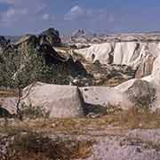
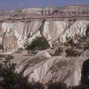
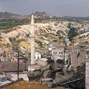
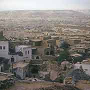
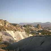
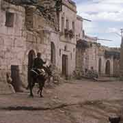
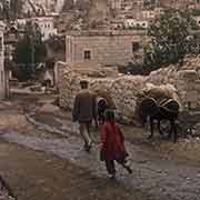
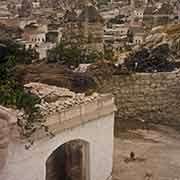
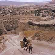
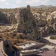
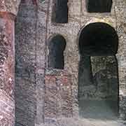
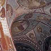
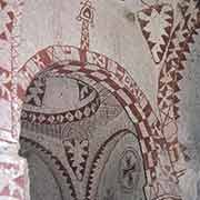
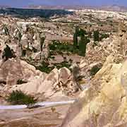
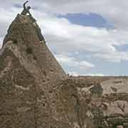
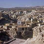
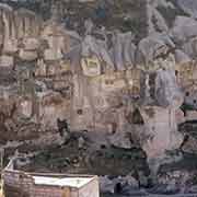
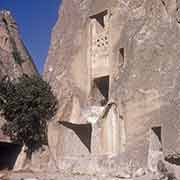
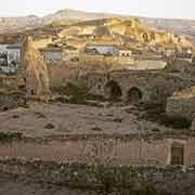
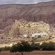
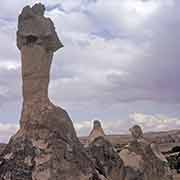
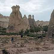
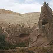
The landscape around Göreme is spectacular, with hundreds of pillars and columns, formed by the erosion of the soft volcanic rocks. Caves may have first been built here by the Phrygians, an Indo-European people, in the 8th–7th centuries BCE. In Roman times the Phrygian language died out and was replaced by Greek. The people, who were now Christians, expanded their underground caverns adding the chapels and inscriptions, like in the underground city of Kaymakli, about 20 kilometres south of the town of Nevşehir. Göreme was a monastic centre in 300–1200 CE and people in the villages carved out houses, churches and monasteries in the soft volcanic rocks. The churches and frescoes are on display in what is now the Göreme Open Air Museum, a vast complex with cave churches and frescoes from the 10th to 12th centuries. Cave dwellings may be visited in Ortahisar, central among the Cappadocian towns. The region is now the Göreme National Park, occupying an area of nearly 100 km², with spectacular landscapes, underground churches and dwellings.