Photos of Panmunjom and the DMZ, Gyeonggi Province, Korea


Panmunjom and the DMZ, Gyeonggi Province
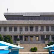
Panmunjom was a village just north of the de facto border between North and South Korea, where the 1953 Korean Armistice Agreement that paused the Korean War was signed (as a Peace Treaty was never signed, the two sides are technically still at war). Panmunjom itself no longer exists as an inhabited village as it was destroyed during the war. About 800 meters south of where the village proper used to be is the Joint Security Area (JSA), the only place on the Korean Demilitarised Zone (DMZ) where North and South Korean forces stand face-to-face.
you may then send it as a postcard if you wish.
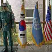
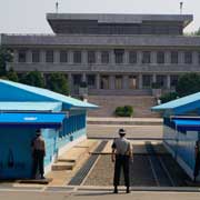
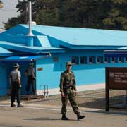
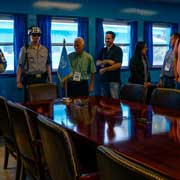
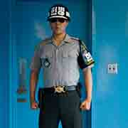
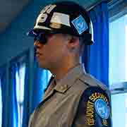
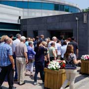
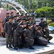
The JCA may be visited on a guided tour by the US Military. Before entering the DMZ, tourists are given a briefing during which they must sign a document which states, in part, “The visit to the Joint Security Area at Panmunjom will entail entry into a hostile area and possibility of injury or death as a direct result of enemy action”. The Armistice building straddles the Military Demarcation Line, where discussions between North and South still occur; when walking around the table, you technically cross into North Korea. Inside, South Korean JSA (Joint Security Area) soldiers stand in their “Modified Taekwondo Stance”, complete with sunglasses. They also stand outside, menacingly staring at Panmungak, the main North Korean building, where a single soldier in a more relaxed pose may be seen.
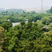
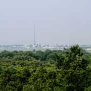
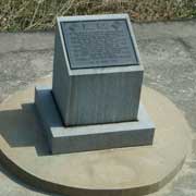
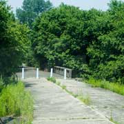
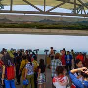
From the observation tower, you can observe the North Korean “Peace Village” Kijong-dong with its 160 metres high flagpole; apparently, not many people live there, but lights come on in the evening as if it is inhabited. On the South Korean side is the “TSD Freedom Village”, also with a high flagpole, once the tallest, until the North built one higher still. The Bridge of No Return on the border is still there: after the war, soldiers could decide which way to go, north or south; once they crossed that bridge, there was no going back. There is also a memorial at the spot where a tree was being trimmed, and two UN Command officers who were supervising were axed to death by North Korean guards on 18 August 1976.
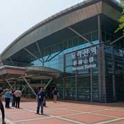
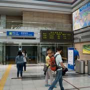
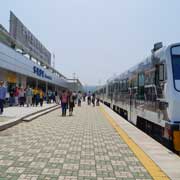
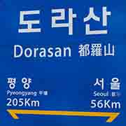
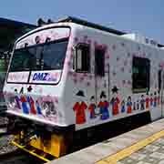
About 10 kilometres south is Dorasan Station, a railway station on the line which once connected North and South Korea. From December 2007 to December 2008, freight trains crossed the border, taking materials to the Kaesong Industrial Region in North Korea and returning with finished goods; however, the North closed it again. Only tourist trains from Seoul arrive here, although signs inside still optimistically point to the track going to Pyongyang. Nearby is the Third Tunnel, one of the four known invasion tunnels dug by North Koreans and detected in June 1978 when an underground explosion was heard; the tunnellers had progressed 435 metres under the south side of the Korean Demilitarized Zone (DMZ). It took four months to locate it and dig an intercept tunnel. Tourists can now walk as far as a concrete barricade, one of three that block it from the North. Initially, the North denied it being a tunnel, but a coal mine: they had blackened the walls! However, it is granite, where coal is never found.