Photos from the Top End, Australia

THE TOP END OF AUSTRALIA AND ARNHEM LAND
A short profile of the Top End and Arnhem Land
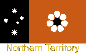
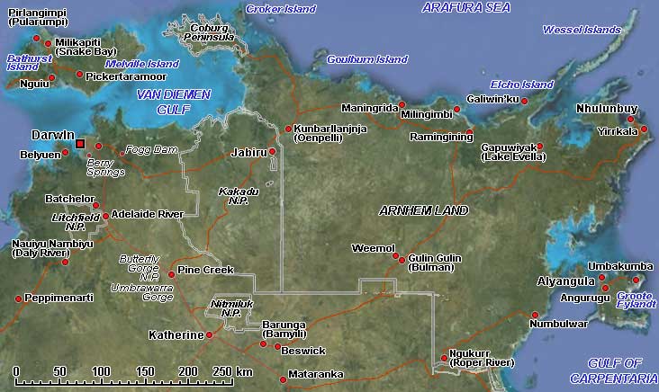
The “Top End of Down Under”, the northern part of the Northern Territory of Australia, is a lush tropical land with rivers, wetlands and waterfalls. Darwin, the capital of the Northern Territory, is the logical starting point. The Tiwi Islands are, apart from Tasmania, the largest islands off the Australian coast. They lie 80 kilometres north of Darwin in the Arafura Sea. There are two main islands, Bathurst Island and Melville Island, with a total landmass of 8,320 km².
Arnhem Land, named after a Dutch ship that was itself named after a Dutch town, is a large Aboriginal Reserve in the far north of the Northern Territory of Australia. This is all Aboriginal land, and outsiders may only visit it with the permission of its Aboriginal owners. It is a vast, wild land with breathtaking scenery and long, sandy roads, dusty in the Dry and totally impassable in the wet season. There are small remote Aboriginal “Homeland Centres” where people have returned to live on their ancestral land. However, houses are now built, and there is a water bore, often a generator, solar-powered satellite telephone and even an airstrip! Total isolation is a thing of the past, even in this vast and empty land.
Arnhem Land is home to people speaking many different languages, and often people can speak and understand as many as five. In Arnhem Land, many of those languages vary greatly. Although most are threatened with extinction now or are already no longer spoken by the younger generation, some are still flourishing and are the everyday means of communication.
Apart from the mainland communities of Arnhem Land, there are also several permanently inhabited islands. In those places, traditional life is still well and truly flourishing and where the Yolngu (Aboriginal) people are happy to share their culture, song and dance with the outside world.