Photos of Uluru-Kata Tjuta National Park, Central Australia, Australia


Uluru-Kata Tjuta National Park, Central Australia
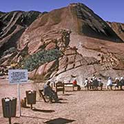
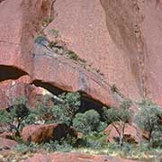
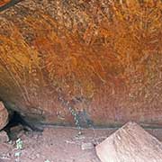
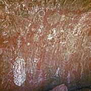
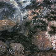
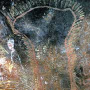
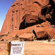
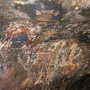
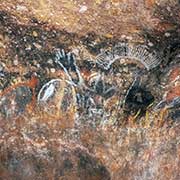
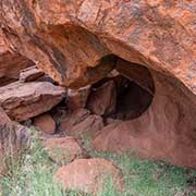
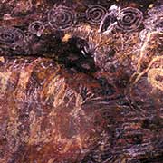
One of Australia’s best-known sights is “the largest pebble in the world,” Ayers Rock or Uluru, as it has always been known to the local Aboriginal people, to whom “The Rock” has immense spiritual importance. They are the custodians of this important site, rich in mythology, with caves still off-limits to uninitiated people: signs warning visitors.
you may then send it as a postcard if you wish.
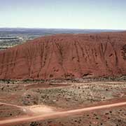
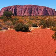
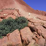
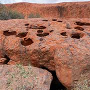
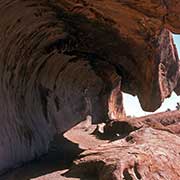
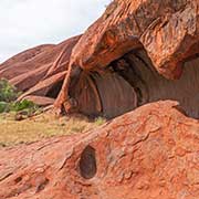
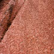
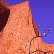
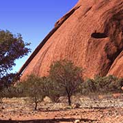
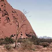
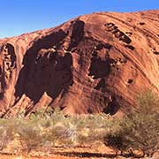
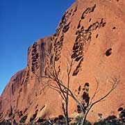
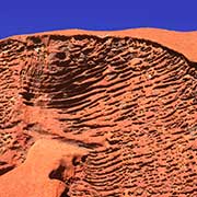
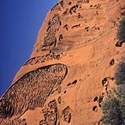
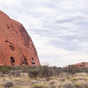
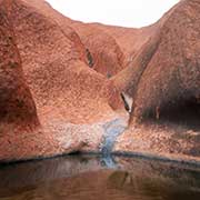
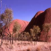
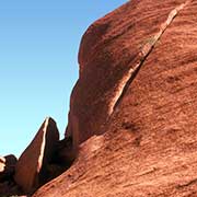
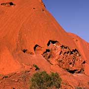
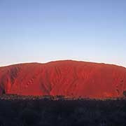
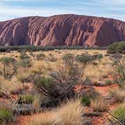
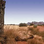
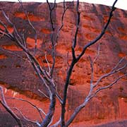
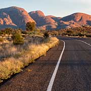
The geological story of Uluru is that about 600 million years ago, movements of plates in the earth’s crust pushed up mountains; subsequent heavy weathering, first by the actions of an inland sea and rain and later on by sun, wind and occasional rain has eroded most of this mountain away, leaving the summit of Uluru standing 348 metres above the plain (863 metres above sea level); the Rock is 3.6 kilometres long, with steep slopes. It probably extends a kilometre or more beneath the surface. The weathering continues, as can be seen by the “flaking” of the surface, caused by alternate heating in the sun and cooling at night. The red colour (which seems to change depending on the sun’s angle) is caused by an iron oxide coating.
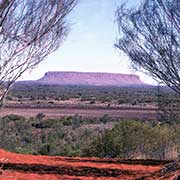
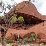
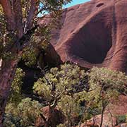
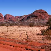
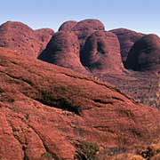
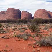
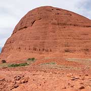
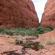
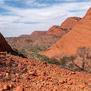
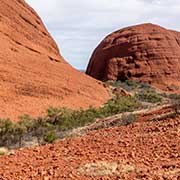
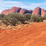
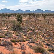
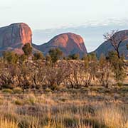
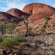
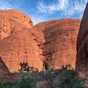
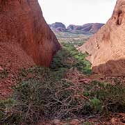
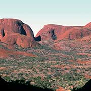
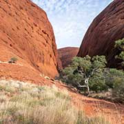
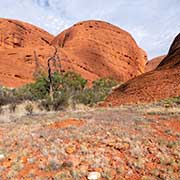
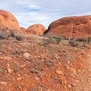
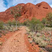
About 30 kilometres west of Uluru is Kata Tjuta, meaning “many heads”, with 36 individual rock domes that once may have been a single dome, much larger than Uluru: Mount Olga or, to the Aboriginal people, Wanambi-pidi, the highest point, rises about 550 metres above the plain (1066 metres above sea level). It is also a site of incredible beauty and ceremonial significance. Some beautiful walks may be taken here, like the 6 kilometres hike through the Valley of the Winds or the Walpa Gorge Walk: “Walpa” means wind; it is the breath of Wanambi, the Rainbow Serpent, huge, brightly coloured, with a flowing beard, a mane and long teeth that lives here. On the summit of Uluru is a steep-sided rock hole, and this, too, is the home of an enormous Wanambi with skin in the colours of the rainbow: a form he often assumes.
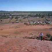
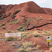
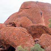
The traditional Aboriginal custodians are collectively called “Anangu” and comprise three main groups: Pitjantjatjara, Yankunytjatjara and Ngaanyatjara. The cultural region of these desert peoples extends over huge distances as far as Western and South Australia. Fundamental to their way of life is “Tjukurpa”. Sometimes referred to as “Dreaming” by non-Aborigines, it is an all-encompassing term meaning Aboriginal Law and the explanations of the features of the land, among others. The various features of Uluru and Kata Tjuta are associated with ancient beliefs and can be seen by walking; there used to be a walking trail to the top of Uluru, although Anangu preferred visitors walk around Uluru rather than climbing it: it is a sacred site and they would never do this. Also, it was not without danger (there were plaques commemorating tourists who died here, mainly from falls and heart attacks).
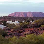
At last, on 28 October 2019, the trail was permanently closed, and climbing is no longer permitted. Climbing Kata Tjuta was already strictly forbidden for much longer. There are displays and demonstrations of Anangu culture at the Uluru-Kata Tjuta Cultural Centre, not far from Uluru’s southwest. The township of Yulara, with Ayers Rock Resort, about 14 kilometres (25 kilometres by road) north of Uluru, where accommodation, from camping sites to luxury hotels, may be found. The Aboriginal community of Mutitjulu, a few kilometres east of Uluru, is not open to visitors.